by Cormac Walsh
The Wadden Sea constitutes an inter-tidal coastal landscape, reaching from Den Helder in the Netherlands, along the German North Sea coast to Blavands Huk in southwestern Denmark. This coastal landscape has been shaped over a period of a thousand years or more by dyke-building, land reclamation and drainage practices as well as periodic storm flood events producing a material and symbolically powerful boundary between the land and the sea. Today the inter-tidal landscape in front of the dykes is recognised as a unique, ecologically rich and diverse ecosystem of outstanding natural value with the status of a UNESCO World Heritage site. The status of the Wadden Sea as a natural landscape is nevertheless contested, particularly among the coastal communities for whom this coastal landscape is their home-place or Heimat (Walsh 2017).
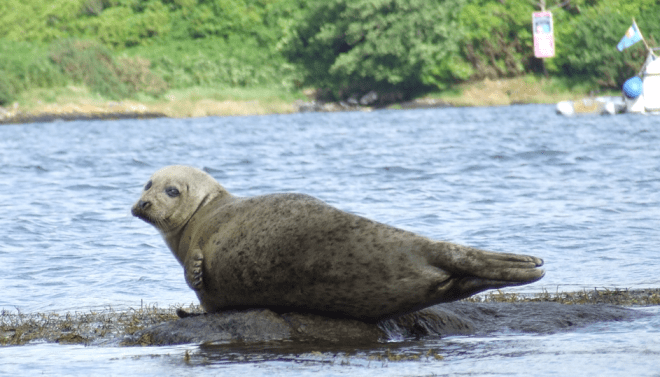
The tidal landscape of the Wadden Sea coast has been argued to present a ‘mental provocation’, challenging the image of a clear and secure line of separation between land and sea, constitutive for modern scientific and administrative understandings of the ‘coast’ (Fischer, L. 2011). The Wadden Sea presents a challenge to this – literally – linear understanding of the coast in two senses: firstly the fluctuation and fluidity of the barrier between land and sea is prominently visible through the extensive diurnal tidal range, characteristic of this low-lying coast. Secondly, the historical record documents substantial shift in the physical location of the coastline as the consequence of catastrophic storm events, processes of erosion and sedimentation as well as practices of land reclamation. Since the construction of the first dykes in the twelfth century, the boundary between the land and the sea has been progressively pushed westward through extensive dyke-building and land reclamation (Krauß 2005). The history of the coastal landscape is also marked by catastrophic storm-flood events, which resulted in extensive loss of life, land and livelihoods. A storm-flood, recorded to have occurred on the 16th of January 1362 led to the loss of Rungholt in Northern Friesland, an important regional trading centre of time. Similarly engrained in the historical memory of the region is a storm flood event in 1634, which claimed almost 10,000 lives and the island of Strand (Quedens 2010). In Eastern Friesland, the village of Itzendorf was lost to the ‘Christmas Flood’ of 1717. In more recent times, a storm surge in February 1962 brought extensive damage along the North Sea coast and tested the existing system of dykes to their limits and beyond in a number of cases.
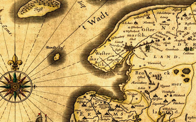
Map of Eastern Friesland showing the lost village of Itzendorf, northwest of the town of Norden, by Ubbo Emmius (dated 1595).
Continue reading →